Mount Merapi Eruption V2 (2010)
Location and facts
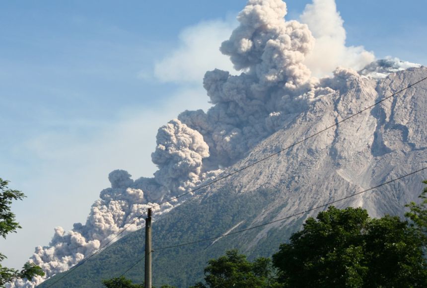
Mount Merapi is in Indonesia, on the island of Java. It is one of the world’s most active volcanoes. The Indo-Australian Plate is being forced under the Eurasian Plate, which causes frequent eruptions. In October–November 2010, a major eruption had devastating effects on the region.

what happened?
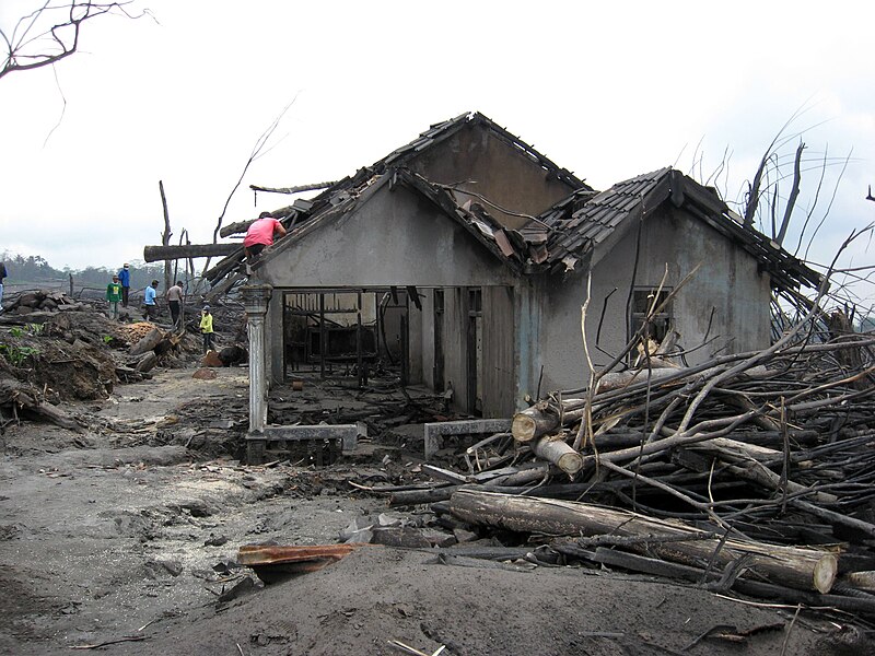
In October 2010, signs of volcanic activity increased. The government warned residents, but many refused to leave. On 26 October, Mount Merapi erupted violently. It sent pyroclastic flows (fast-moving clouds of hot gas and ash) down the slopes, destroying everything in their path. Over the next few weeks, more eruptions followed, forcing 350,000 people to evacuate.
primary impacts
(The short-Term Effects)
- 353 people died due to pyroclastic flows and ash inhalation.
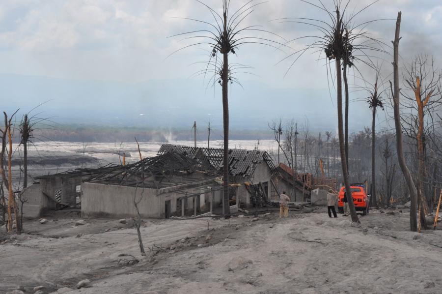
- Hot ash and volcanic bombs destroyed homes, bridges, and farmland.
- Ash clouds disrupted flights across Indonesia and neighboring countries.
- Villages were covered in ash, making farming impossible.
secondary impacts
(the long-term impacts)
- Lahars (volcanic mudflows) formed after heavy rain, destroying more homes and roads.
- Crops and livestock were lost, damaging the economy.
- The local economy collapsed, as businesses, tourism, and agriculture were affected.
- Water supplies were polluted by ash, causing health issues
response
(how did people react)
local response
- 350,000 people evacuated, but some people refused to leave.
- Emergency shelters provided food, water, and medical help.
- Masks were handed out to reduce ash inhalation.
- The Indonesian government gave financial aid to farmers and businesses
international response
- The United Nations, Red Cross, and NGOs sent emergency aid.
- Countries like Australia, the USA, and Japan gave money and supplies.
- Scientists helped improve early warning systems to prevent future disasters.
knowledge check
Check your understanding
multiple choice quiz
exam style questions
- Describe
- Describe
- Explain
- Explain
- Assess
- Evaluate
flashcards – do you know your key terms?
Struggling with some answers?
Our full Geography Booster Course covers this in depth – enrol now!